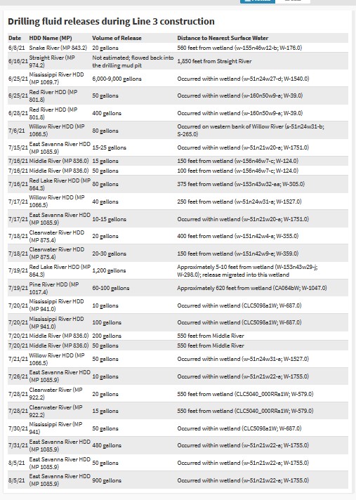
A Watch the Line volunteer put together a map showing all the places that Enbridge Line 3 has had frac-outs. Enbridge is drilling under 21 waters and wetlands using a technique called horizontal directional drilling. The process requires drilling mud to lubricate and cool the drill. The process happens under pressure and the drilling mud can get forced into cracks in the subsurface soils and get pushed to the surface, showing up in on land or in waterways.
The following summarizes all of the frac-outs.

From June 8 to Aug. 5, there were:
- Two frac-outs at Clearwater River Crossing #1
- Two frac-outs at Clearwater River Crossing #2
- Six frac-outs at the East Savanna River Crossing
- Four at the Middle River crossing
- Three at the Mississippi River crossing #1
- One at the Pine River crossing
- Two at the Red Lake River crossing
- One at the Snake River crossing
- Three at the Willow River crossing
- Two at the Red River crossing
- One at the Straight River crossing
- One at Mississippi River crossing #2
The following table gives the dates, locations, and amounts of spills.